Explore Our Comprehensive Solutions: Geospatial Intelligence, Drone Services, and Environmental Research
Geospatial Intelligence
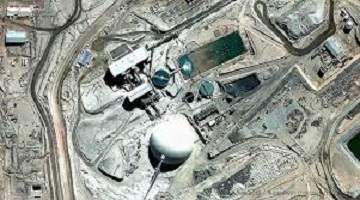
At GISorb, our Geospatial Intelligence service leverages advanced technology to collect, analyze, and visualize spatial data. By transforming complex geospatial information into clear, actionable insights, we help our clients make informed decisions and achieve their goals. Our expertise includes:
Data Collection: Using state-of-the-art sensors and satellite imagery, we gather precise and comprehensive spatial data.
Data Analysis: Our team employs sophisticated analytical tools to process and interpret the data, revealing patterns and trends.
Data Visualization: We create intuitive maps and visualizations that make complex information easily understandable.
Whether you need detailed land use analysis, urban planning support, or natural resource management, our Geospatial Intelligence service provides the insights necessary for strategic decision-making. With GISorb, you gain a competitive edge through accurate, timely, and relevant geospatial information tailored to your specific needs.

Drone Services
At GISorb, our Drone Services offer cutting-edge solutions for a wide range of applications, delivering unmatched accuracy and efficiency. Utilizing the latest drone technology, we provide high-resolution aerial data and imagery to help our clients achieve their objectives. Our services include:
Aerial Mapping: We create detailed, high-resolution maps for various industries, including agriculture, construction, and real estate.
Land Surveying: Our drones capture precise topographical data, making land surveys faster, safer, and more cost-effective.
Infrastructure Inspection: We conduct thorough inspections of infrastructure such as bridges, power lines, and pipelines, identifying issues before they become critical.
Environmental Monitoring: Our drones monitor environmental changes, track wildlife, and assess natural resources, supporting conservation and sustainability efforts.
By offering a bird’s-eye view and the ability to access hard-to-reach areas, GISorb's Drone Services provide our clients with valuable insights that drive smarter decisions and enhance operational efficiency. Experience the future of data collection and analysis with GISorb's advanced drone technology.

Environmental Research
At GISorb, our Environmental Research services are dedicated to advancing sustainability and understanding our natural world. We combine scientific expertise with cutting-edge technology to deliver comprehensive environmental assessments and solutions. Our offerings include:
Ecological Assessments: We conduct thorough evaluations of ecosystems to understand biodiversity, habitat health, and ecological balance.
Environmental Impact Studies: Our team analyzes the potential effects of development projects on the environment, helping clients mitigate risks and comply with regulations.
Natural Resource Management: We provide strategies for the sustainable use and conservation of natural resources, ensuring long-term ecological and economic benefits.
Climate Monitoring: Utilizing advanced sensors and data analytics, we track climate patterns and changes, aiding in climate adaptation and resilience planning.
GISorb’s Environmental Research services equip clients with the knowledge and tools needed to make informed decisions that support environmental stewardship and sustainable development. By turning data into actionable insights, we help safeguard our planet for future generations.

Ready to transform your data into powerful insights? Partner with GISorb and harness the power of Geospatial Intelligence, innovative Drone Services, and comprehensive Environmental Research. Contact us today to discover how our cutting-edge solutions can help you achieve your goals and drive sustainable success. Let's elevate your capabilities together—get in touch with GISorb now!
Unlock the Potential of Your Data Today: Take the First Step Towards Smarter Decisions with GISorb!